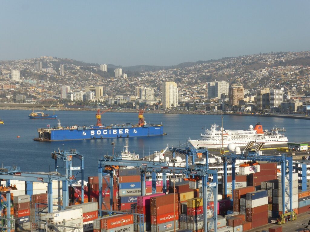
Most people meet Valparaíso through a photograph: a jumble of painted houses tumbling towards a container port, a wooden funicular car halfway up a cliff, a mural three storeys high. All of that is real, but the pictures miss the logic that holds it together. This is a working port that grew up a wall of hills, and once you understand how the bay, the flat strip of the Plan and the cerros above it fit together, the city stops looking like chaos and starts reading like a book. Here is how I would spend a few days in Chile’s most stubbornly original city.
Read the Amphitheatre Before You Climb It
Valparaíso is built like a theatre. The bay is the stage; the Plan, a narrow coastal flat that is largely reclaimed land, is the front row; and more than forty hills rise behind it in tiers, each one cut off from its neighbours by steep ravines. Locals talk about going “up” or “down” rather than north or south, and every neighbourhood has its own staircases, viewpoints and character.
That shape explains the city’s history. In the late nineteenth century Valparaíso was the first and most important merchant port on the Pacific coast of South America, the place where ships rounding the Strait of Magellan took on coal, cargo and crew. British, German, Italian and French merchants settled here, and their banks, churches and houses still mark the hills. The opening of the Panama Canal in 1914 ended that boom, and the slowdown that followed is precisely why so much of the old fabric survived.
In 2003 UNESCO inscribed the Historic Quarter of the Seaport City of Valparaíso on the World Heritage List as an exceptional testimony to the early phase of globalisation. The protected core is small, just 23.2 hectares, and it covers five interlaced areas: the La Matriz church and Plaza Santo Domingo, Plaza Echaurren and Calle Serrano, the Muelle Prat with Plaza Sotomayor and Plaza Justicia, Calle Prat and Plaza Turri at the foot of the hills, and the twin hills of Cerro Alegre and Cerro Concepción. Keep that map in your head and the city becomes far easier to navigate.
Ride the Ascensores, Then Walk Down
The single best piece of advice I can give is this: go up by funicular and come down on foot. Valparaíso once had around thirty ascensores; sixteen historic ones survive and are protected as national monuments. Technically almost all are funiculars, small wooden or metal cars hauled up rails at improbable angles. The exception is the Ascensor Polanco, a true vertical lift reached through a tunnel.
The Ascensor Concepción, opened in 1883, is the oldest of the survivors and the obvious first ride, rising from near Calle Prat to Paseo Gervasoni on Cerro Concepción. El Peral climbs from beside the law courts at Plaza Justicia to Paseo Yugoslavo and the Palacio Baburiza, home of the city’s fine arts museum. Reina Victoria links Avenida Elías with Cerro Alegre. Each ride lasts only a minute or two.
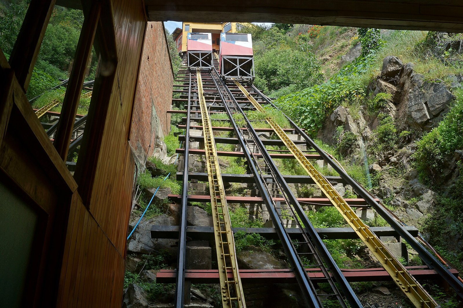
Not every line is running, and that is worth knowing before you plan a route. The users’ association Ascenval lists Concepción, El Peral, Reina Victoria, Barón, Cordillera, Espíritu Santo and San Agustín with daily timetables, while La Cruz has been out of service since September 2024. The Ascensor Artillería, which serves the classic bay viewpoint on Paseo 21 de Mayo, has been closed for about five years; in September 2026 local media reported that the Ministry of Public Works was reworking its restoration tender, leaving the reopening without a date and possibly pushed to 2027. You can still reach the viewpoint by road or on foot, but check the current status on Ascenval’s site before relying on any single funicular.
Cerro Alegre and Cerro Concepción: The UNESCO Core
These two hills form a single neighbourhood that was planned and settled largely by British and German immigrants, and it shows. Look for the Lutheran Church of the Holy Cross and the Anglican St Paul’s on Cerro Concepción, the corrugated-iron façades painted in saturated colours to protect them from salt air, and the paseos, those narrow promenades that hang over the edge with views straight down onto the port.
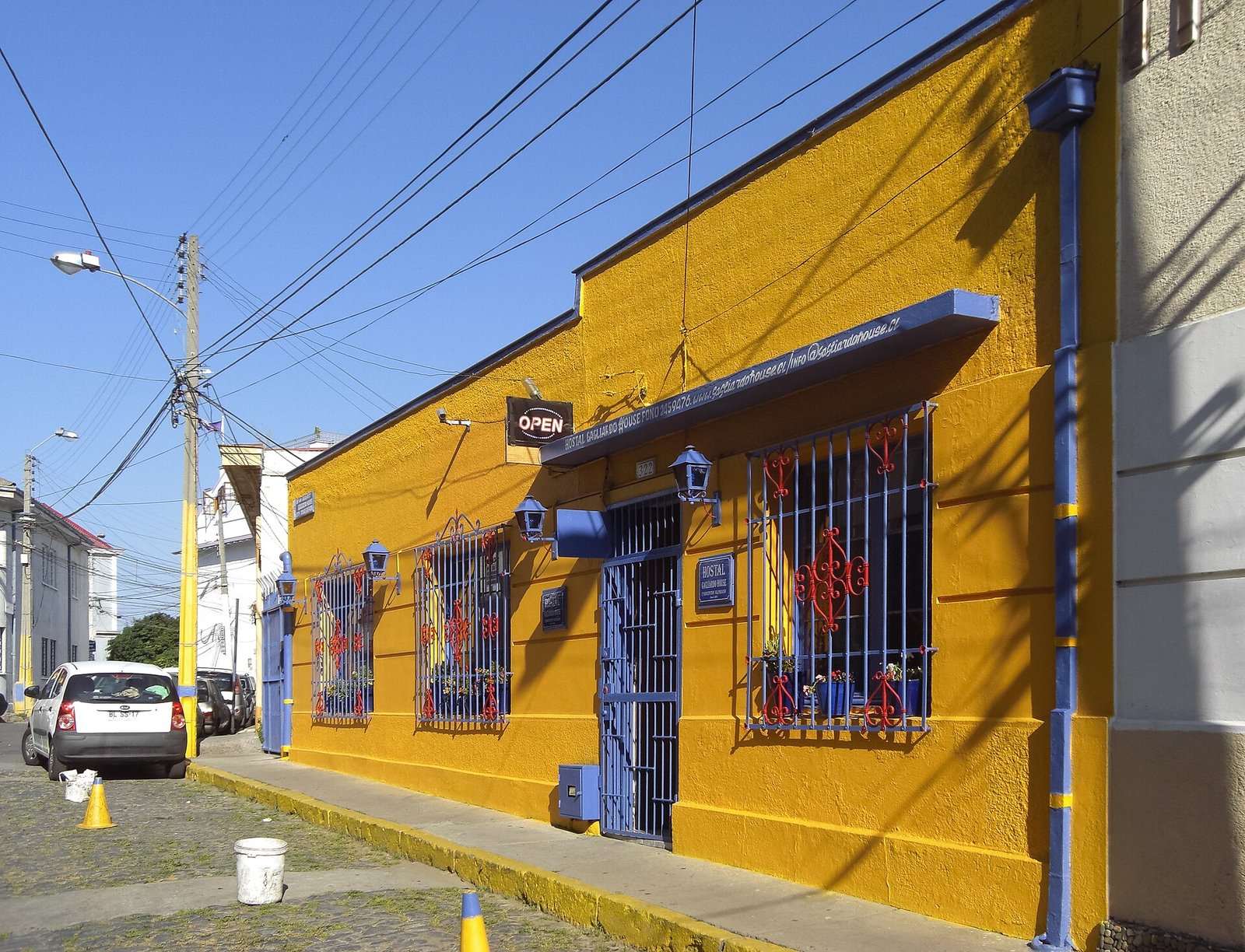
The best way to explore is without a fixed plan. Start at Paseo Gervasoni, drift along Paseo Atkinson, cross into Cerro Alegre through the lanes around Calle Templeman and Pasaje Gálvez, and finish at Paseo Yugoslavo at sunset. Remember that these are residential streets, not a theme park: keep voices down on the stairways, ask before photographing people at their doors, and resist the urge to sit on someone’s front step for the perfect shot. The cafés, galleries and guesthouses that have opened here in the past two decades have brought money, but also real pressure on long-time residents.
Street Art, Neruda and the Hills Beyond the Postcard
Valparaíso is one of the great street art cities of the world, and walls here are canvases in a way that feels organic rather than curated. On Cerro Concepción, Pasaje Beethoven and the surrounding alleys are dense with large-scale murals; on Cerro Alegre, the stairways around Pasaje Gálvez are layered with work that changes from one visit to the next.

To see the older layer, head east to Cerro Bellavista and its Museo a Cielo Abierto, an open-air circuit of murals by Chilean artists painted along the hill’s streets and stairways. From there it is a short climb to La Sebastiana, Pablo Neruda’s house on Calle Ricardo de Ferrari. The building was left unfinished by its first owner, the Spaniard Sebastián Collado, and Neruda completed it with friends, inaugurating it on 18 September 1961 and naming it after the original builder. It was looted after the 1973 coup, restored, and opened as a museum in 1991. Climb to the top-floor study, where the poet watched the bay and the New Year’s fireworks, and you will understand why he chose it. The house is run by the Fundación Pablo Neruda, opens Tuesday to Sunday and admits visitors in order of arrival, so check the foundation’s website for current times.
Down in the Plan: Port, Markets and Chorrillana
Many visitors stay up on the hills and treat the Plan as something to cross quickly. That is a mistake. Plaza Sotomayor, with the monument to the heroes of the Battle of Iquique and the naval headquarters behind it, opens onto Muelle Prat, where small boats offer short trips around the harbour past cranes, warships and container ships. This is still a working port, and watching it work is part of the point.
For food, walk east to the Almendral district and Mercado Cardonal, which has been supplying the city with fruit and vegetables since the early twentieth century. The ground floor is all produce, cheese and dried fruit; upstairs, cocinerías serve seafood and Chilean home cooking. Go in the morning, and keep an eye on your bag in the crowds.
Then there is the chorrillana, Valparaíso’s gift to late-night eating: a platter of chips buried under strips of beef, fried onion and egg, designed for sharing. The Casino Social J. Cruz, a cluttered old bar off Calle Condell, claims to have invented it in the 1970s for students who drank on empty stomachs. Whether or not the story is true, a chorrillana and a glass of red in a bar of the Plan is as porteño as it gets.
Practical Valparaíso: Getting There, Staying Safe, When to Go
Most travellers arrive from Santiago. Frequent direct buses run from the capital’s Terminal Alameda and Terminal Pajaritos to the Terminal Rodoviario on Avenida Pedro Montt; the journey usually takes around an hour and three-quarters, longer in weekend traffic. From the terminal, a taxi or local bus will take you up to your hill.
- Where to stay: Cerro Alegre and Cerro Concepción have the densest choice of guesthouses and small hotels, and put you within walking distance of the funiculars. Cerro Bellavista is quieter and close to La Sebastiana. If you want beaches and modern high-rises, base yourself in Viña del Mar and commute.
- Safety: Petty theft is the main risk. Carry little, keep your phone out of reach on crowded streets, avoid empty stairways and the port area after dark, and use registered taxis or ride-hailing at night.
- When to go: The southern summer, December to March, is dry and lively but crowded, and New Year’s Eve brings one of the biggest fireworks displays in the country. Spring and autumn are calmer and often the best balance; winter is cooler and wetter.
Viña del Mar, a short ride along the coast on the Metro Valparaíso suburban rail line, is the polished counterpart: wide beaches, gardens and a seafront promenade. It also carries scars. In February 2024 wildfires tore through the hills of Viña del Mar, Quilpué and neighbouring communes; prosecutors now count 138 deaths, making it Chile’s deadliest disaster since the 2010 earthquake. Around 90 per cent of the National Botanical Garden was burned. Reconstruction in the affected neighbourhoods is ongoing, so if you visit, spend locally and check the garden’s status before planning a trip there.
Valparaíso rewards slowness. Give it at least two full days, take the funiculars that are running, walk down every staircase you can, and let the city teach you its own geography.
More in Travel · Valparaíso
Featured image: The bay and hills of Valparaíso from Cerro Artillería. Photo: Carlos Teixidor Cadenas / Wikimedia Commons, CC BY-SA 4.0