Category: Travel
Tags: Laos · Luang Prabang · UNESCO · Mekong · Wat Xieng Thong
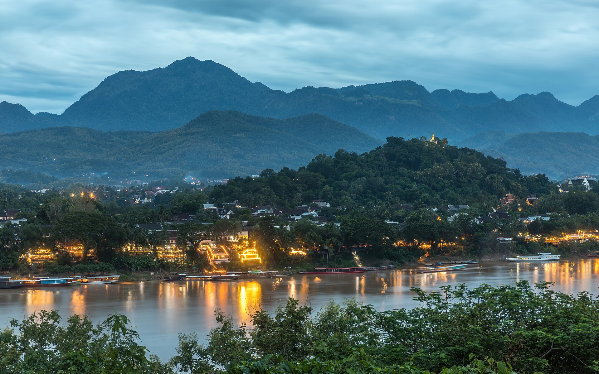
Luang Prabang does not sit beside the Mekong as a riverfront strip. It occupies a peninsula: the Mekong on one flank, the Nam Khan on the other, limestone hills closing the basin. From the air the town is a narrow finger of streets and roofs. On the ground it is a sequence of wats, wooden houses and colonial brick façades that only make sense if you keep the two rivers in your head.
That settlement is a UNESCO World Heritage property. The Town of Luang Prabang was inscribed in 1995, World Heritage List reference 479 (ICOMOS advisory evaluation N0735), under criteria (ii), (iv) and (v). The property covers 820 hectares, with a buffer zone of 12,560 hectares, in Luang Prabang Province, Lao People's Democratic Republic. UNESCO's brief synthesis is precise: an outstanding fusion of traditional Lao urban architecture with nineteenth- and twentieth-century European colonial building, on a peninsula formed by the Mekong and the Nam Khan, with sacred Mount Phousi at the heart of the historic town.
A town organised by two rivers
The useful map is not a grid. It is the peninsula.
UNESCO places the political and religious centre on that spit of land: royal and noble residences, religious foundations, and the older village fabric, each village historically organised around its temple. French colonial street morphology overlapped that pattern rather than erasing it. The main spine—often called Sisavangvong Road in tourist English—runs the length of the peninsula. Temples and former royal buildings line one side; traditional and colonial houses the other. Mount Phousi rises in the middle of the historic core like a survey point you should fix early, because every later walk will be measured against it.
Before the colonial period, Luang Prabang was not a European-style city at all. ICOMOS's 1995 evaluation (dossier N0735) stresses the point: neither Luang Prabang nor Vientiane conformed to the European urban concept. They were defended royal and religious complexes with adjacent monasteries, around which distinct village communities clustered. The commercial life sat in those villages, not in a single mercantile downtown. From the fourteenth to the sixteenth century the place—then known as Xieng Thong among other names—was capital of Lan Xang, the “Kingdom of a Million Elephants.” In 1560 the royal capital shifted to Vientiane; the town took the name Luang Prabang from the Prabang Buddha image brought earlier from Cambodia. After the French protectorate of 1893, and under King Sisavang Vong, it again functioned as royal and religious capital until Vientiane became the administrative capital in 1946.
What you walk today is that layered sequence: Theravada Buddhist monasteries in wood and stone; vernacular Lao houses raised on piles; brick colonial buildings with wooden balconies along the Mekong. UNESCO is blunt about pressure. Rapid development and tourism already threaten integrity—change of use, departure of residents, illegal construction. The town is not a set. It is a living peninsula that has to absorb more visitors than the streets were built for.
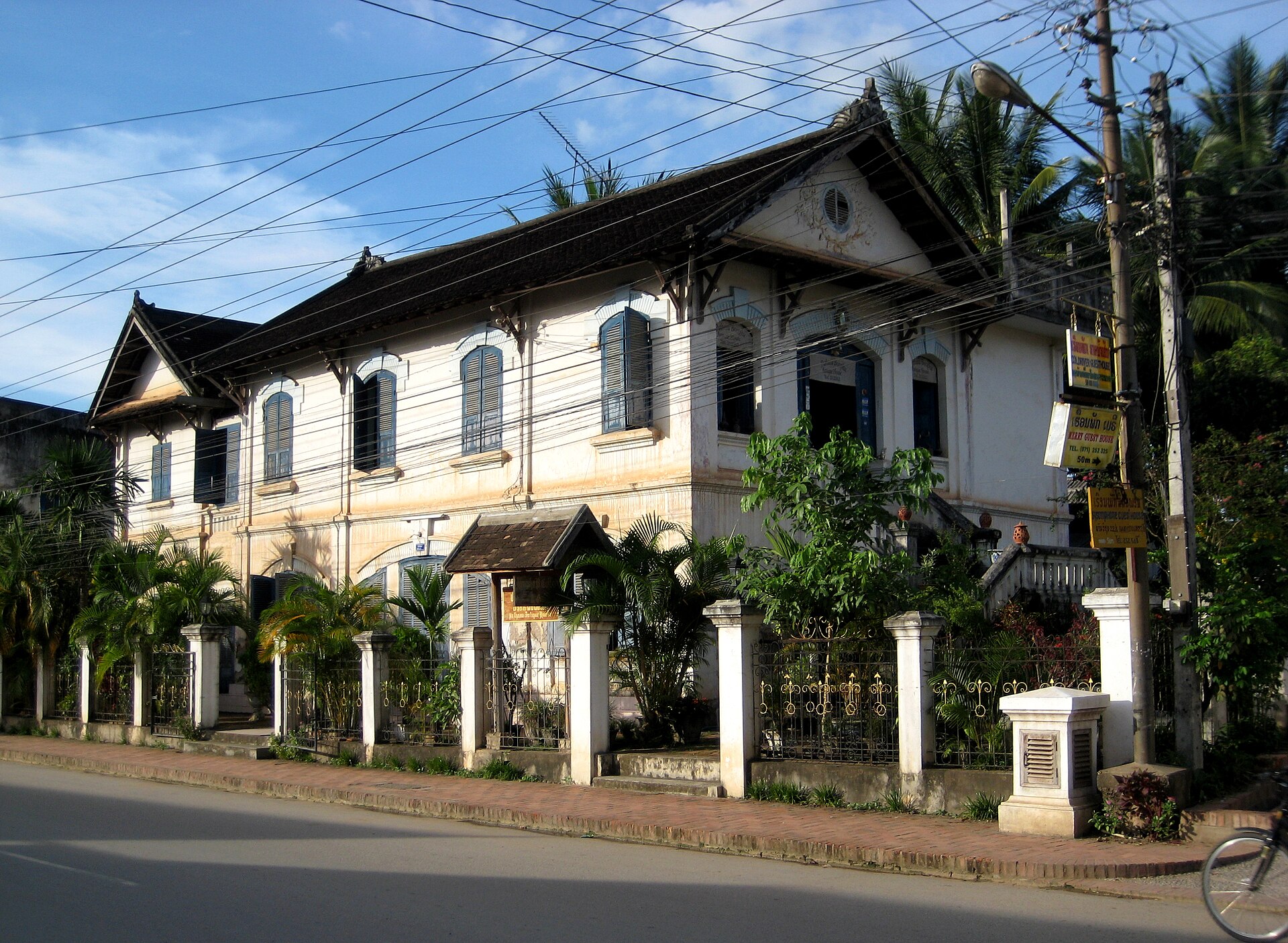
Wat Xieng Thong, and the rest of the peninsula's temples
Treat the wats as a working religious landscape, not as a scrapbook of golden roofs.
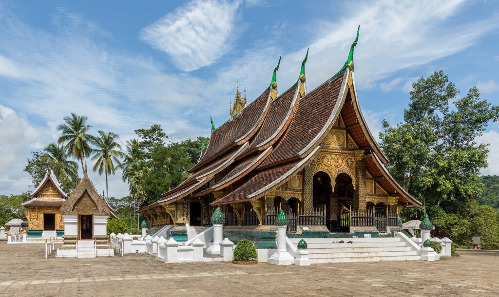
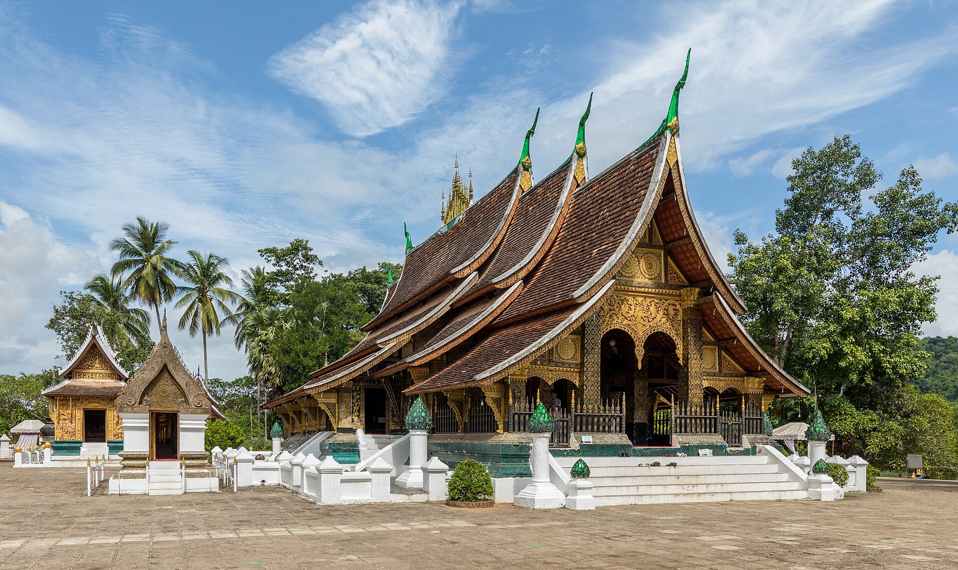
Wat Xieng Thong sits at the tip of the peninsula where the Mekong and Nam Khan meet. UNESCO describes it as dating from the sixteenth century and as comprising “an ensemble of the most complex structures of all the pagodas of the town,” remarkable archaeologically and in Lao iconography. ICOMOS's inventory material linked to the evaluation dates the complex to 1560. The roofs sweep low; the mosaics—especially the well-known tree-of-life work—read best when you are not sharing the courtyard with three tour groups timed to the same mid-morning slot. Lonely Planet's practical advice matches the grain of the place: go early or late, cover shoulders and legs, and leave time for quieter compounds off the main spine rather than stacking every famous façade into a single morning.
There are dozens of monasteries in and around the historic centre. UNESCO's own integrity note treats temples, public buildings and traditional houses as the significant elements that still hold. The Ho Pha Bang and the Pha Bang image are part of the town's namesake story; Mount Phousi's That Chomsi stupa is the vertical marker above the streets. Secondary wats—those that Lonely Planet and local guides name as quieter, among them compounds such as Wat Xieng Mouane or That Makmo—matter because they keep the peninsula from collapsing into a single “must-see” temple. A walk that only photographs Wat Xieng Thong has missed the urban structure UNESCO inscribed: villages with temples, not a cathedral quarter with a ticket booth.
Do not invent a spiritual experience you did not have. Enter compounds with covered shoulders and knees, keep your voice down, and treat photographing monks as a last option, not a default. The architecture explains itself if you give it time. The mosaics and roof lines are denser when you have already walked the length of the peninsula and felt how the rivers pinch the streets.
Tak bat: watch, do not stage
The morning alms round—tak bat—is a Theravada practice, not a product.
Before dawn, monks and novices leave the monasteries in line to receive sticky rice and other offerings from residents kneeling along the route. UNESCO's brief synthesis lists the monks' morning quest among the living practices that still sanctify the place. Lonely Planet's 2025 guidance is unusually direct for a guidebook: the ceremony has taken on a circus atmosphere in places, with video, flash photography and tour groups turning a quiet exchange into a performance. Their recommendation for most visitors is to skip participation and learn about Lao Buddhism another way; if you do want to see the round, stand back, prefer quieter side streets off the main tourist strip, and treat observation as the ethical default.
If you insist on offering, do it as a resident would, not as a content creator. Modest dress that covers shoulders and legs; stay silent; do not block the line, step over bowls, or tower above kneeling locals for a camera angle. Do not buy packaged snacks from opportunistic vendors on the spot. Ask a reputable guesthouse the evening before for sticky rice prepared for the purpose, and follow their instruction on how and where to kneel. Better still: donate uncooked rice, oil, eggs or other staples directly to a monastery outside the dawn spectacle. The point of tak bat is merit and sustenance for the sangha. Your photograph is not part of that transaction.
A few habits keep the ritual from becoming another ingredient in a peninsula checklist. Arrive before the crowd if you must watch; leave before you become the crowd; never chase a line of monks down the street. The town's monks are not extras in your itinerary. They are the reason the wats still function as monasteries rather than as empty shells with gift shops.
Mount Phousi, then the Mekong again
Mount Phousi (Phou Si) is the short vertical climb at the centre of the historic town. UNESCO calls it sacred and places it at the heart of the peninsula between Mekong and Nam Khan. That Chomsi, the stupa on the summit, is the usual destination. Lonely Planet notes the climb for sunset views—and the crowds that gather for the same light.
Go at sunrise if you want the geography rather than the silhouette party. From the top you can read the peninsula as UNESCO describes it: two rivers, the ridge of hills, the denser fabric of roofs and temple compounds. The view is useful as orientation, not as a trophy. Climb, fix the map in your head, descend, and spend the day on the streets you have just seen from above. Sunset on Phousi is legitimate; treating it as the only reason to climb is how the summit becomes another flattened postcard.
After the hill, return to the water. The Mekong was the country's transport spine long before asphalt and rail. A boat trip—whether a short sunset circuit or a longer run toward the Pak Ou caves—is still one of the clearest ways to feel why the town sits where it does. Choose operators who treat the river as a working corridor, not as a floating bar. The peninsula only holds if you keep remembering that it is defined by water on both sides.
Kuang Si as a day trip, not a checkbox
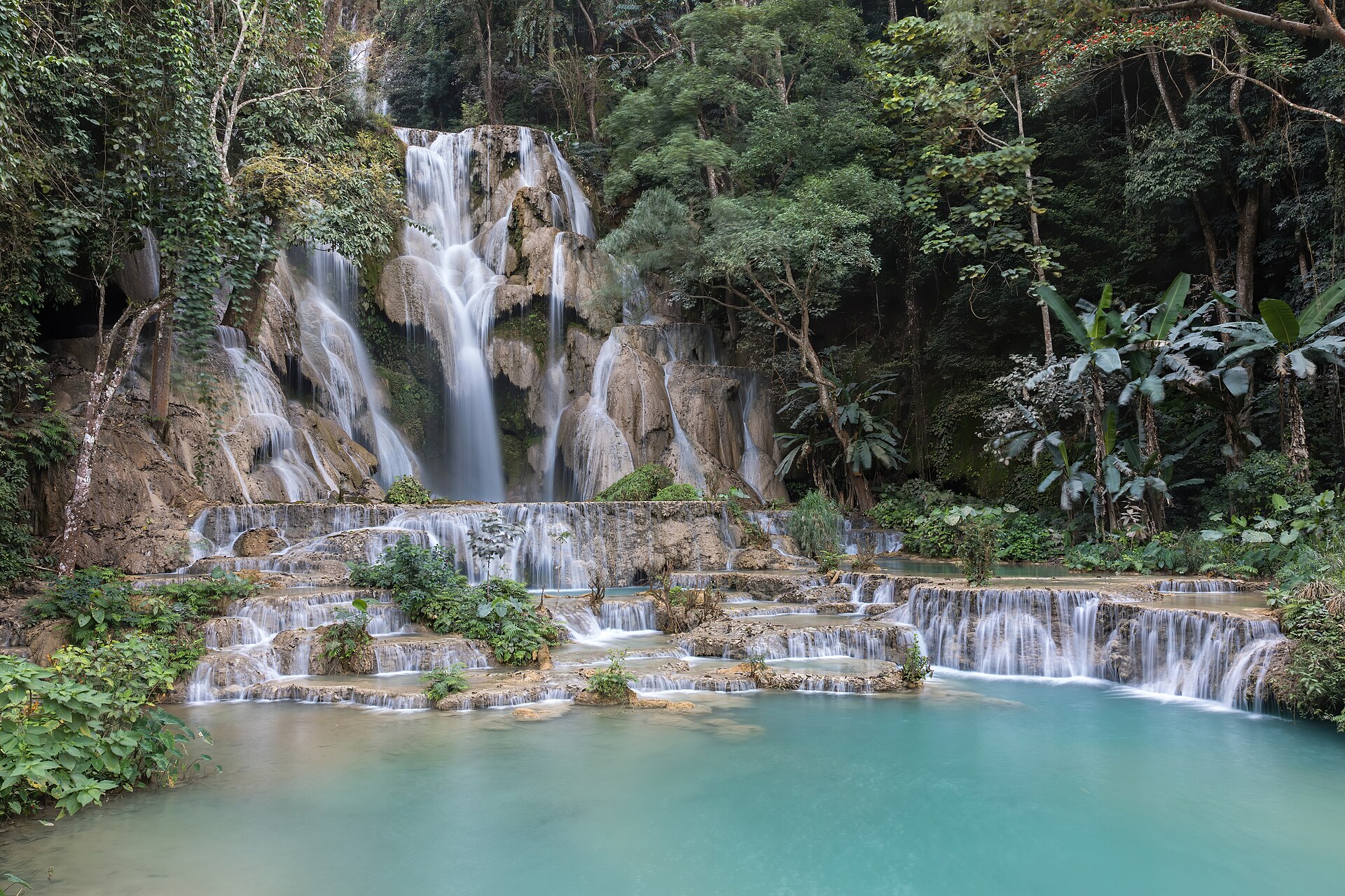
Kuang Si (Tat Kuang Si) is a tiered waterfall complex roughly 29 kilometres south of town—Wikimedia Commons and local guides converge on that distance. The pools are the colour people come for; the densest crowds arrive with the mid-morning vans. Lonely Planet's advice is operational rather than lyrical: enter at opening, or in the last two hours before close, when tour buses thin. Swim only where swimming is allowed. Visit the Free the Bears rescue centre on site if you want the day to include something other than turquoise water and a picnic.
Do not treat Kuang Si as proof that you “did” Luang Prabang. The falls sit outside the World Heritage property. They are a legitimate half-day in a wider northern Laos itinerary; they are a poor substitute for walking the peninsula's grain. Combine them with a farm or craft stop on the road if you have the hours, or leave them for a second day if the town's streets still feel unread. The mistake is the same one Matera visitors make with a single viewpoint: confusing a famous exterior with the structure of the place.
The railway, the season, and staying in proportion
Since 3 December 2021 the Boten–Vientiane railway—the Lao section of the Laos–China Railway—has put Luang Prabang on a high-speed corridor that did not exist for most of the town's modern tourism history. Fast services cut the Vientiane–Luang Prabang run from a six- or seven-hour road journey to roughly two hours (press and travel reporting commonly cite about two hours; schedule tables for the line put the Luang Prabang–Vientiane segment near that mark on express services). Lonely Planet now frames the town as straining under package traffic the new line makes easy. UNESCO had already flagged tourism-driven change of use and resident departure in the property's integrity statement. The railway did not invent that pressure. It accelerated access.
Arrive by train if it suits your route; do not arrive as if the peninsula were a half-day stop between Vientiane and a Chinese border crossing. Book accommodation on or near the historic core with the dry-season peak in mind. November through February is the practical window: cooler, drier air, clearer light on the rivers and cleaner colour in the Kuang Si pools. It is also peak season. Rooms and train seats go early. March into the hotter months raises heat and haze; the wet season greens the hills and can muddy the falls. None of that is a reason to avoid the town. It is a reason to plan the sequence of your days instead of improvising a checklist under midday heat.
A few habits keep a visit from flattening the peninsula. Walk the tip—Wat Xieng Thong and the confluence—early, before the tour vans. Use Mount Phousi for orientation, not only for sunset. Watch tak bat from a side street or skip it; never stage it. Give at least one full day to streets and secondary wats with no waterfall attached. Hire a boatman who knows the Mekong as a working river. At Kuang Si, arrive at opening or late, and leave when the pools feel like a swimming club. Spend money where residents still live: markets, small guesthouses, craft workshops that pay artisans, monasteries that accept direct donations. Ask what a restored colonial façade actually replaced. That conversation is worth more than another identical photograph of a golden roof.
Luang Prabang has already survived royal capital, colonial overlay, inscription, and a railway that collapsed the distance from Vientiane. The useful way to see it is to accept the complication: a Theravada monastery town, a French-era street plan, a World Heritage buffer under strain, and a peninsula that only holds if visitors refuse to treat every dawn, every stupa and every turquoise pool as content. Walk until the Mekong and Nam Khan are no longer a backdrop and have become the reason the streets end where they do. Then climb Phousi once, look back, and keep the map.
Sources
- UNESCO World Heritage Centre, “Town of Luang Prabang.” https://whc.unesco.org/en/list/479/
- ICOMOS Advisory Body Evaluation N0735 / UNESCO dossier for Luang Prabang (1995). https://whc.unesco.org/archive/advisory_body_evaluation/479.pdf
- UNESCO World Heritage Committee, Decision 19 COM VIII.C.1, inscription of the Town of Luang Prabang, 1995. https://whc.unesco.org/en/decisions/3092/
- Lonely Planet, “10 of the best things to do in Luang Prabang, Laos” (Cindy Fan, updated Dec 2025; Tak Bat, Kuang Si, Wat Xieng Thong, Phou Si, railway tourism pressure). https://www.lonelyplanet.com/articles/top-things-to-do-in-luang-prabang-laos
- Sydney Morning Herald Traveller, “Luang Prabang to Vientiane by train: New railway cuts six-hour journey to two” (railway opened 3 Dec 2021; ~2-hour journey). https://www.smh.com.au/traveller/inspiration/luang-prabang-to-vientiane-by-train-new-railway-cuts-sixhour-journey-to-two-20230203-h29l9k.html
- Wikipedia / published timetable summaries for Boten–Vientiane railway (station times; Luang Prabang as major passenger stop). https://en.wikipedia.org/wiki/Boten–Vientiane_railway